
Handeni topographic map
Interactive map
Click on the map to display elevation.
About this map
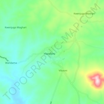
Name: Handeni topographic map, elevation, terrain.
Location: Handeni, Handeni Town, Tanga, Northern Zone, Tanzania (-5.46709 37.98302 -5.38709 38.06302)
Average elevation: 698 m
Minimum elevation: 582 m
Maximum elevation: 1,030 m