
Vilãs topographic map
Interactive map
Click on the map to display elevation.
About this map
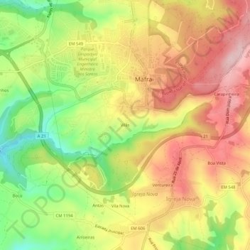
Name: Vilãs topographic map, elevation, terrain.
Location: Vilãs, Mafra, Lisboa, 2640-495 MAFRA, Portugal (38.90966 -9.35203 38.94966 -9.31203)
Average elevation: 196 m
Minimum elevation: 57 m
Maximum elevation: 315 m