
El Kennar Nouchfi topographic map
Interactive map
Click on the map to display elevation.
About this map
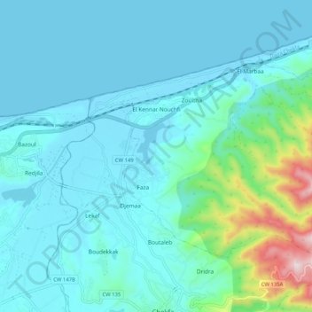
Name: El Kennar Nouchfi topographic map, elevation, terrain.
Location: El Kennar Nouchfi, Chekfa District, Jijel, Algeria (36.78551 5.93631 36.83915 6.03902)
Average elevation: 82 m
Minimum elevation: 0 m
Maximum elevation: 591 m