
Flagler Beach topographic map
Interactive map
Click on the map to display elevation.
About this map
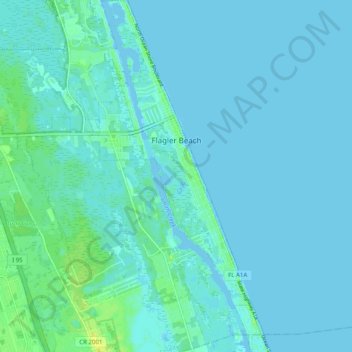
Name: Flagler Beach topographic map, elevation, terrain.
Location: Flagler Beach, Flagler County, Florida, United States (29.42261 -81.15134 29.50941 -81.10238)
Average elevation: 3 m
Minimum elevation: -4 m
Maximum elevation: 15 m
Other topographic maps
Click on a map to view its topography, its elevation and its terrain.
Bunnell
United States > Florida > Flagler County
Bunnell, Flagler County, Florida, 32110, United States
Average elevation: 7 m
Palm Coast
United States > Florida > Flagler County
Palm Coast, Flagler County, Florida, United States
Average elevation: 6 m