
南城社区 topographic map
Interactive map
Click on the map to display elevation.
About this map
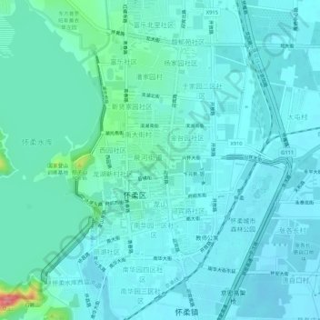
Name: 南城社区 topographic map, elevation, terrain.
Location: 南城社区, 怀柔区, 北京市, 101422, 中国 (40.29980 116.61019 40.33980 116.65019)
Average elevation: 53 m
Minimum elevation: 40 m
Maximum elevation: 132 m