Geolocate

Pagdildilan topographic map

Click on the map to display elevation.

About this map
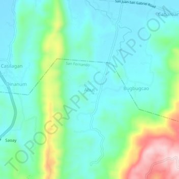
Name: Pagdildilan topographic map, elevation, terrain.

Location: Pagdildilan, San Juan, La Union, Ilocos Region, 2513, Philippines (16.62823 120.35134 16.66823 120.39134)

Average elevation: 90 m

Minimum elevation: 5 m

Maximum elevation: 320 m

Other topographic maps

Click on a map to view its topography, its elevation and its terrain.

Urbiztondo Beach

Philippines > La Union > San Juan

Average elevation: 13 m

Gear up for your next adventure:

🧷Tenacious Repair Tape - Instant fix for torn tents, jackets, or dry bags
📐Altimeters & Barometers - Tools for measuring altitude and air pressure
👕Technical Hiking Tees - Moisture-management for high-exertion climbs
🩹Hiking First Aid Kits - Compact medical kits tailored for trail injuries and emergencies
🧢Waterproof Hiking Hats - Keep the rain off your face while studying topographic maps

As an Amazon Associate, this site earns from qualifying purchases at no extra cost to you.