Geolocate

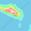
Gourna topographic map

Click on the map to display elevation.

About this map

Name: Gourna topographic map, elevation, terrain.

Location: Gourna, Municipality of Leros, Kalymnos Regional Unit, South Aegean, Aegean, 854 00, Greece (37.13291 26.81302 37.17291 26.85302)

Average elevation: 41 m

Minimum elevation: -1 m

Maximum elevation: 197 m

Other topographic maps

Click on a map to view its topography, its elevation and its terrain.

Gear up for your next adventure:

🚲Bikepacking Frame Bags - Storage for tools and navigation gear on long off-road rides
👟Men's Trail Running Shoes - Lightweight grip for fast movement over topographic contours
🧊Personal Water Filters - Drink safely from mountain streams marked on your map
🦶Anti-Blister Balms - Protect your feet before long topographic expeditions
🛰️Handheld GPS Devices - Reliable GPS units for hiking and outdoor navigation

As an Amazon Associate, this site earns from qualifying purchases at no extra cost to you.