Capilla del Monte topographic map
Click on the map to display elevation.
Capilla del Monte
Cerro Uritorco is the highest mountain in the Sierras Chicas mountain range, with an elevation of 1900 meters above sea level. Even though the government of Capilla del Monte has tried to expropriate Cerro Uritorco, it continues to have a private administration, and both tourists and locals have to pay an entry fee to access the premises. The summit can be reached in about 3 hours. On the way up, there is a wide range of vegetation, waterfalls, ponds, and water springs. At the summit is a view of the town, the El Cajón Dam, and the huge salt pans on the north of the province of Córdoba, which are known as Salinas Grandes. Several cases of UFO sightings have been reported in the areas surrounding Cerro Uritorco, which is why the mountain is believed to be a center of extraterrestrial activity. It is also believed that the mountain is home to an underground city named Erks, where the chosen ones will be able to take refuge once the apocalypse arrives. Several books have been written on the matter. All these occurrences have contributed to Cerro Uritorco being associated with mysticism and strange happenings.
About this map
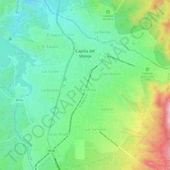
Name: Capilla del Monte topographic map, elevation, terrain.
Average elevation: 1,017 m
Minimum elevation: 894 m
Maximum elevation: 1,287 m
Other topographic maps
Click on a map to view its topography, its elevation and its terrain.