Geolocate

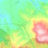
Sadra topographic map

Click on the map to display elevation.

About this map

Name: Sadra topographic map, elevation, terrain.

Location: Sadra, Shiraz Central District, Shiraz County, Fars Province, Iran (29.75499 52.41367 29.84605 52.57813)

Average elevation: 1,850 m

Minimum elevation: 1,593 m

Maximum elevation: 2,316 m

Other topographic maps

Click on a map to view its topography, its elevation and its terrain.
Darian

Iran > Fars Province > Shiraz County

Average elevation: 1,642 m

Darian

Iran > Fars Province > Shiraz County

Average elevation: 1,642 m

Darreh

Iran > Fars Province > Shiraz County > دهستان سیاخ

Average elevation: 1,761 m

Gear up for your next adventure:

🧤Waterproof Overmitts - Extreme weather protection for hikers and mountaineers
🧺Ultralight Dry Bags - Organize and waterproof your gear inside your rucksack
🔭Compact Hiking Binoculars - Lightweight optics for scouting terrain and spotting wildlife
🎒Hiking Backpacks - Comfortable backpacks for day hikes and multi-day treks
🕶️Polarized Sunglasses - Reduces glare from snow and water when reading terrain

As an Amazon Associate, this site earns from qualifying purchases at no extra cost to you.