
São Filipe topographic map
Interactive map
Click on the map to display elevation.
About this map
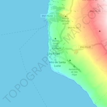
Name: São Filipe topographic map, elevation, terrain.
Location: São Filipe, 8220, Cape Verde (14.85530 -24.53694 14.93530 -24.45694)
Average elevation: 127 m
Minimum elevation: 0 m
Maximum elevation: 641 m
Other topographic maps
Click on a map to view its topography, its elevation and its terrain.