Geolocate

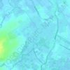
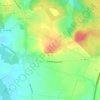
Bajus topographic map

Click on the map to display elevation.

About this map

Name: Bajus topographic map, elevation, terrain.

Location: Bajus, Béthune, Pas-de-Calais, Hauts-de-France, Metropolitan France, 62150, France (50.41108 2.45421 50.43247 2.48872)

Average elevation: 115 m

Minimum elevation: 72 m

Maximum elevation: 169 m

Other topographic maps

Click on a map to view its topography, its elevation and its terrain.

Panehem

France > Hauts-de-France > Pas-de-Calais > Samer

Average elevation: 70 m

Le Petit Vimy

France > Hauts-de-France > Pas-de-Calais > Vimy

Average elevation: 93 m

Noyelles

France > Hauts-de-France > Pas-de-Calais > Bours

Average elevation: 125 m

Gear up for your next adventure:

🍳Camping Stoves - Compact stoves for outdoor cooking
👕Merino Base Layers - Natural temperature regulation for cold weather hiking and camping
🧊Personal Water Filters - Drink safely from mountain streams marked on your map
🌂Windproof Trekking Umbrellas - Surprising but effective rain protection on low-wind trails
🗺️Scratch-off Peak Maps - Track your progress climbing Munros or Wainwrights

As an Amazon Associate, this site earns from qualifying purchases at no extra cost to you.