
Montazzolino topographic map
Interactive map
Click on the map to display elevation.
About this map
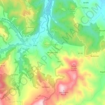
Name: Montazzolino topographic map, elevation, terrain.
Location: Montazzolino, Montefortino, Fermo, Marche, 63858, Italia (42.92003 13.32555 42.96003 13.36555)
Average elevation: 624 m
Minimum elevation: 455 m
Maximum elevation: 856 m
Other topographic maps
Click on a map to view its topography, its elevation and its terrain.
Lago di Gerosa
Italia > Marche > Fermo > Montefortino > Arato
Lago di Gerosa, Arato, Montefortino, Fermo, Marche, 63087, Italia
Average elevation: 731 m