
Bera Upazila topographic map
Interactive map
Click on the map to display elevation.
About this map
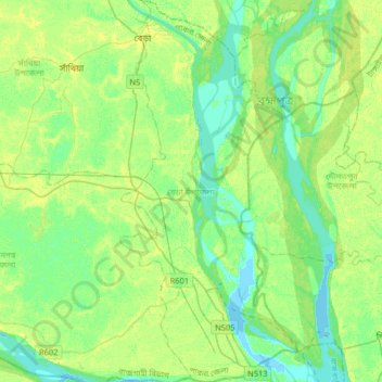
Name: Bera Upazila topographic map, elevation, terrain.
Location: Bera Upazila, Pabna District, Rajshahi Division, Bangladesh (23.81043 89.59100 24.10702 89.74198)
Average elevation: 8 m
Minimum elevation: -2 m
Maximum elevation: 19 m
Other topographic maps
Click on a map to view its topography, its elevation and its terrain.