
Thank you for supporting this site ❤️
Make a donation
Make a donation
Gear up for your next adventure:
As an Amazon Associate, this site earns from qualifying purchases at no extra cost to you.
Saman topographic map
Click on the map to display elevation.
Thank you for supporting this site ❤️
Make a donation
Make a donation
Gear up for your next adventure:
As an Amazon Associate, this site earns from qualifying purchases at no extra cost to you.
About this map
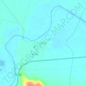
Name: Saman topographic map, elevation, terrain.
Location: Saman, Samán, Province of Azángaro, Puno, Peru (-15.31152 -70.03718 -15.27152 -69.99718)
Average elevation: 3,824 m
Minimum elevation: 3,815 m
Maximum elevation: 3,899 m
Thank you for supporting this site ❤️
Make a donation
Make a donation
Gear up for your next adventure:
As an Amazon Associate, this site earns from qualifying purchases at no extra cost to you.