
Aurai topographic map
Click on the map to display elevation.
About this map
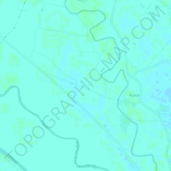
Name: Aurai topographic map, elevation, terrain.
Location: Aurai, Auraiy, Muzaffarpur, Bihar, 843312, India (26.29727 85.54362 26.33727 85.58362)
Average elevation: 55 m
Minimum elevation: 52 m
Maximum elevation: 58 m