Geolocate

Singat topographic map

Click on the map to display elevation.

About this map

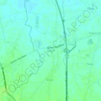
Name: Singat topographic map, elevation, terrain.

Location: Singat, Gerona, Tarlac, Central Luzon, 2312, Philippines (15.59452 120.60438 15.63452 120.64438)

Average elevation: 25 m

Minimum elevation: 20 m

Maximum elevation: 30 m

Gear up for your next adventure:

🎒Hiking Child Carriers - Explore the outdoors with the whole family safely
Lightweight Solo Tents - Backpacking tents designed for wild camping in the UK highlands
🧥Waterproof Hiking Jackets - Rain protection for walking in all weather conditions
🌄Outdoor Binoculars - Compact binoculars for landscape observation
📍Handheld GPS Navigators - Reliable satellite navigation for hiking and off-road exploration

As an Amazon Associate, this site earns from qualifying purchases at no extra cost to you.