Geolocate

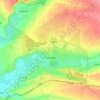
Stepove topographic map

Click on the map to display elevation.

About this map

Name: Stepove topographic map, elevation, terrain.

Location: Stepove, Stepnohirska settlement hromada, Vasylivka Raion, Zaporizhia Oblast, 71621, Ukraine (47.53795 35.46203 47.54723 35.49707)

Average elevation: 85 m

Minimum elevation: 47 m

Maximum elevation: 98 m

Other topographic maps

Click on a map to view its topography, its elevation and its terrain.
Melitopol

Ukraine > Zaporizhia Oblast > Melitopol

Average elevation: 37 m

Polohy

Ukraine > Zaporizhia Oblast

Average elevation: 137 m

Tokmak

Ukraine > Zaporizhia Oblast

Average elevation: 64 m

Tytove

Ukraine > Zaporizhia Oblast

Average elevation: 190 m

Chernihivka

Ukraine > Zaporizhia Oblast

Average elevation: 159 m

Melitopol

Ukraine > Zaporizhia Oblast

Average elevation: 26 m

Marfopil

Ukraine > Zaporizhia Oblast

Average elevation: 125 m

Gear up for your next adventure:

🧭GPS Trackers - Tracking devices for safety and navigation
🗺️Topographic Maps - Detailed maps showing elevation and terrain features
🎒Hiking Daypacks - Compact backpacks ideal for short hikes and excursions
🔋Solar Power Banks - Keep your GPS and phone charged during multi-day expeditions
👖Convertible Hiking Trousers - Versatile zip-off pants for changing mountain weather conditions

As an Amazon Associate, this site earns from qualifying purchases at no extra cost to you.