Geolocate

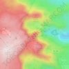
Sameiro topographic map

Click on the map to display elevation.

About this map

Name: Sameiro topographic map, elevation, terrain.

Location: Sameiro, Manteigas, Guarda, Portugal (40.39063 -7.51122 40.44782 -7.45160)

Average elevation: 924 m

Minimum elevation: 553 m

Maximum elevation: 1,297 m

Other topographic maps

Click on a map to view its topography, its elevation and its terrain.

Penhas Douradas

Portugal > Guarda > Manteigas

Average elevation: 1,337 m

Cântaro Magro

Portugal > Guarda > Manteigas

Average elevation: 1,725 m

Portela

Portugal > Guarda > Manteigas > Vale da Amoreira

Average elevation: 637 m

Penhas Douradas

Portugal > Guarda > Manteigas

Average elevation: 1,337 m

Gear up for your next adventure:

🛌Sleeping Mats - Insulated mats for comfortable outdoor sleeping
📷Outdoor Action Cameras - Cameras designed for hiking and adventure
🎒Hiking Daypacks (20L) - Compact backpacks for day trips and technical mountain ascents
🥾Hiking Boot Waterproofing Wax - Maintain the lifespan of your leather trekking boots
🧦Merino Wool Hiking Socks - Moisture-wicking socks to prevent blisters during long mountain walks

As an Amazon Associate, this site earns from qualifying purchases at no extra cost to you.