Geolocate

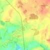
23843 topographic map

Click on the map to display elevation.

About this map

Name: 23843 topographic map, elevation, terrain.

Location: 23843, Bad Oldesloe, Kreis Stormarn, Schleswig-Holstein, Deutschland (53.74651 10.23882 53.87215 10.43654)

Average elevation: 33 m

Minimum elevation: 2 m

Maximum elevation: 76 m

Other topographic maps

Click on a map to view its topography, its elevation and its terrain.
Gear up for your next adventure:

🧦Merino Wool Hiking Socks - Moisture-wicking socks to prevent blisters during long mountain walks
🕶️Polarized Sunglasses - Reduces glare from snow and water when reading terrain
🧢Thermal Beanie Hats - Prevent heat loss from the head in windy summit conditions
🪓Outdoor Multitools - Versatile tools for hiking and camping
👕Technical Hiking Tees - Moisture-management for high-exertion climbs

As an Amazon Associate, this site earns from qualifying purchases at no extra cost to you.