Geolocate

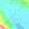
Roy topographic map

Click on the map to display elevation.

About this map
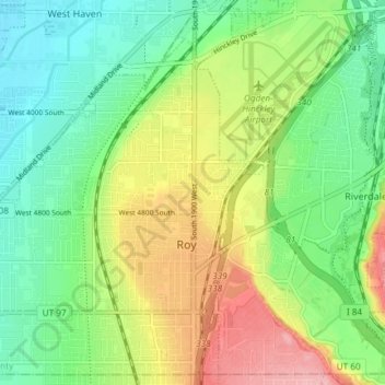
Name: Roy topographic map, elevation, terrain.

Location: Roy, Weber County, Utah, 84067, United States (41.15262 -112.08854 41.20538 -112.01448)

Average elevation: 1,344 m

Minimum elevation: 1,297 m

Maximum elevation: 1,422 m

Other topographic maps

Click on a map to view its topography, its elevation and its terrain.
Powder Mountain

United States > Utah > Weber County

Average elevation: 2,464 m

Eden

United States > Utah > Weber County > Ogden Valley

Eden is a census-designated place in Weber County, Utah, United States. It is home to Powder Mountain ski resort. It lies between the North and Middle Fork of the Ogden River, north of Pineview Reservoir, in the Ogden Valley. The elevation is 4,941 feet (1,506 m). The population was 600 at the 2010 census. It…

Average elevation: 1,562 m

Whisperwood Lotus

United States > Utah > Weber County > Ogden

Average elevation: 1,475 m

Ogden Valley

United States > Utah > Weber County

Average elevation: 1,883 m

Whisperwood Lotus

United States > Utah > Weber County > Ogden

Average elevation: 1,475 m

Eden

United States > Utah > Weber County

Eden is a census-designated place in Weber County, Utah, United States. It is home to Powder Mountain ski resort. It lies between the North and Middle Fork of the Ogden River, north of Pineview Reservoir, in the Ogden Valley. The elevation is 4,941 feet (1,506 m). The population was 600 at the 2010 census. It…

Average elevation: 1,562 m
Eden

United States > Utah > Weber County > Ogden Valley

Average elevation: 1,562 m

Bel-Mar Acres

United States > Utah > Weber County > South Ogden

Average elevation: 1,375 m

Warren

United States > Utah > Weber County

Average elevation: 1,287 m

Liberty Junction

United States > Utah > Weber County > Ogden

Average elevation: 1,323 m

Ben Lomond

United States > Utah > Weber County

Average elevation: 2,453 m

Gear up for your next adventure:

🧭Orienteering Compasses - Accurate compasses for map-based navigation
🎒Hiking Daypacks (20L) - Compact backpacks for day trips and technical mountain ascents
⛺Camping Shelters - Emergency and lightweight shelters for outdoor use
🧢Waterproof Hiking Hats - Keep the rain off your face while studying topographic maps
📢Survival Whistles - Essential safety gear for signaling for help in mountain fog

As an Amazon Associate, this site earns from qualifying purchases at no extra cost to you.