
Bungursari topographic map
Interactive map
Click on the map to display elevation.
About this map
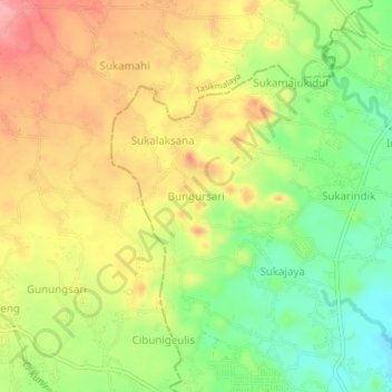
Name: Bungursari topographic map, elevation, terrain.
Location: Bungursari, Tasikmalaya, West Java, Java, 46151, Indonesia (-7.32066 108.14222 -7.28066 108.18222)
Average elevation: 446 m
Minimum elevation: 389 m
Maximum elevation: 501 m