
Ploiești topographic map
Interactive map
Click on the map to display elevation.
About this map
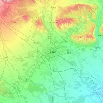
Name: Ploiești topographic map, elevation, terrain.
Location: Ploiești, Prahova, 100XXX, Romania (44.78175 25.86365 45.10175 26.18365)
Average elevation: 187 m
Minimum elevation: 80 m
Maximum elevation: 465 m