
Tanji topographic map
Interactive map
Click on the map to display elevation.
About this map
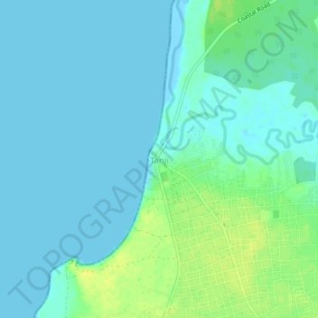
Name: Tanji topographic map, elevation, terrain.
Location: Tanji, Brikama, West Coast Division, The Gambia (13.33856 -16.81751 13.37856 -16.77751)
Average elevation: 6 m
Minimum elevation: -1 m
Maximum elevation: 21 m
Other topographic maps
Click on a map to view its topography, its elevation and its terrain.
Salagi Forest Park
The Gambia > West Coast Division > Kombo North/Saint Mary > Labakoreh
Average elevation: 23 m
Bijilo Forest Park
The Gambia > West Coast Division > Kombo North/Saint Mary > Sukuta
Average elevation: 13 m