
Ladce topographic map
Interactive map
Click on the map to display elevation.
Ladce
The municipality lies at an altitude of 250 metres and covers an area of 15.688 km². It has a population of about 2561 people.
About this map
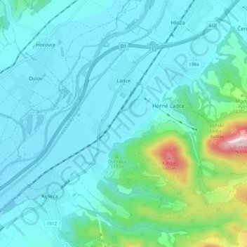
Name: Ladce topographic map, elevation, terrain.
Average elevation: 312 m
Minimum elevation: 237 m
Maximum elevation: 744 m