
Thank you for supporting this site ❤️
Make a donation
Make a donation
Gear up for your next adventure:
As an Amazon Associate, this site earns from qualifying purchases at no extra cost to you.
Cochabamba topographic map
Click on the map to display elevation.
Thank you for supporting this site ❤️
Make a donation
Make a donation
Gear up for your next adventure:
As an Amazon Associate, this site earns from qualifying purchases at no extra cost to you.
About this map
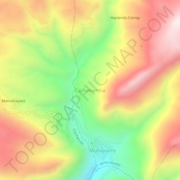
Name: Cochabamba topographic map, elevation, terrain.
Location: Cochabamba, Anco-Huallo, Chincheros, Apurímac, Perú (-13.62240 -73.70789 -13.58240 -73.66789)
Average elevation: 3,578 m
Minimum elevation: 3,102 m
Maximum elevation: 4,020 m
Thank you for supporting this site ❤️
Make a donation
Make a donation
Gear up for your next adventure:
As an Amazon Associate, this site earns from qualifying purchases at no extra cost to you.