
East Oakfield topographic map
Interactive map
Click on the map to display elevation.
About this map
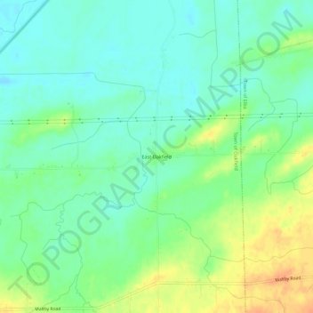
Name: East Oakfield topographic map, elevation, terrain.
Average elevation: 201 m
Minimum elevation: 187 m
Maximum elevation: 224 m
Other topographic maps
Click on a map to view its topography, its elevation and its terrain.
Five Corners
United States > New York > Genesee County > Town of Oakfield
Five Corners, Town of Oakfield, Genesee County, New York, 14125, United States
Average elevation: 223 m