
A Pereira topographic map
Interactive map
Click on the map to display elevation.
About this map
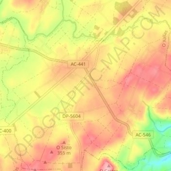
Name: A Pereira topographic map, elevation, terrain.
Location: A Pereira, Santa Comba, Xallas, La Coruña, Galicia, España (42.96442 -8.90242 43.00136 -8.83885)
Average elevation: 323 m
Minimum elevation: 233 m
Maximum elevation: 385 m
Other topographic maps
Click on a map to view its topography, its elevation and its terrain.