
Aranga topographic map
Interactive map
Click on the map to display elevation.
About this map
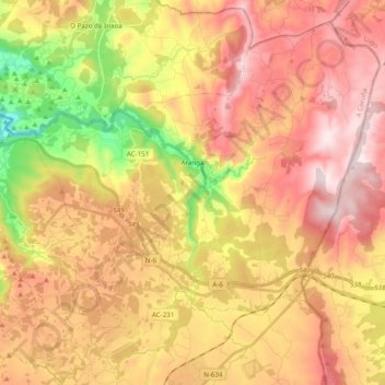
Name: Aranga topographic map, elevation, terrain.
Location: Aranga, Betanzos, A Coruña, Galicien, 15317, Spanien (43.15994 -8.11571 43.28587 -7.92152)
Average elevation: 484 m
Minimum elevation: 160 m
Maximum elevation: 733 m
Other topographic maps
Click on a map to view its topography, its elevation and its terrain.
Oza-Cesuras
Oza-Cesuras, Betanzos, A Coruña, Galicien, Spanien
Average elevation: 295 m