
First Mesa topographic map
Interactive map
Click on the map to display elevation.
About this map
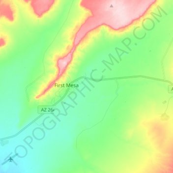
Name: First Mesa topographic map, elevation, terrain.
Average elevation: 1,768 m
Minimum elevation: 1,692 m
Maximum elevation: 1,920 m
Other topographic maps
Click on a map to view its topography, its elevation and its terrain.
Winslow
Vereinigte Staaten von Amerika > Arizona > Navajo County > Winslow
Winslow, Navajo County, Arizona, Vereinigte Staaten von Amerika
Average elevation: 1,495 m