
Vraňany topographic map
Interactive map
Click on the map to display elevation.
About this map
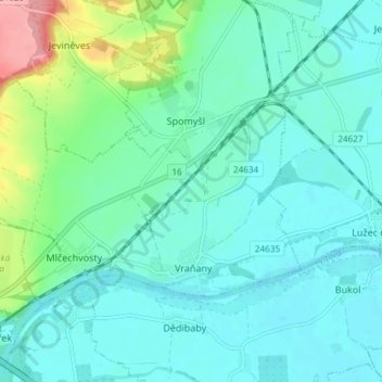
Name: Vraňany topographic map, elevation, terrain.
Location: Vraňany, okres Mělník, Central Bohemia, 27707, Czechia (50.31269 14.30867 50.34062 14.38281)
Average elevation: 182 m
Minimum elevation: 160 m
Maximum elevation: 274 m