
Thank you for supporting this site ❤️
Make a donation
Make a donation
Gear up for your next adventure:
As an Amazon Associate, this site earns from qualifying purchases at no extra cost to you.
Brezje topographic map
Click on the map to display elevation.
Thank you for supporting this site ❤️
Make a donation
Make a donation
Gear up for your next adventure:
As an Amazon Associate, this site earns from qualifying purchases at no extra cost to you.
About this map
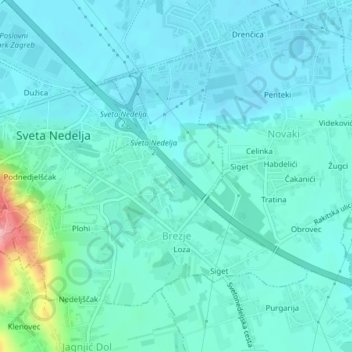
Name: Brezje topographic map, elevation, terrain.
Location: Brezje, Grad Sveta Nedelja, Zagreb County, 10431, Croatia (45.78365 15.77228 45.80345 15.80479)
Average elevation: 143 m
Minimum elevation: 121 m
Maximum elevation: 261 m
Thank you for supporting this site ❤️
Make a donation
Make a donation
Gear up for your next adventure:
As an Amazon Associate, this site earns from qualifying purchases at no extra cost to you.