
Make a donation
Gear up for your next adventure:
As an Amazon Associate, this site earns from qualifying purchases at no extra cost to you.
Glaiten topographic map
Click on the map to display elevation.
Make a donation
Gear up for your next adventure:
As an Amazon Associate, this site earns from qualifying purchases at no extra cost to you.
About this map
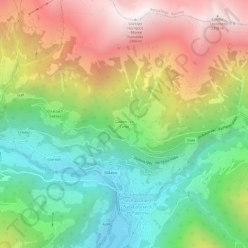
Name: Glaiten topographic map, elevation, terrain.
Average elevation: 1,376 m
Minimum elevation: 640 m
Maximum elevation: 2,378 m
Make a donation
Gear up for your next adventure:
As an Amazon Associate, this site earns from qualifying purchases at no extra cost to you.
Other topographic maps
Click on a map to view its topography, its elevation and its terrain.
Passeiertal
Italien > Trentino-Südtirol > Bozen > St. Leonhard in Passeier
Vorderpasseier steigt aus der durch Weinreben und mediterrane Vegetation geprägten Randzone des Meraner Beckens über Obstplantagen und Weiden bis St. Leonhard auf einer Strecke von ca. 20 km allmählich von ca. 500 m auf ca. 700 m an. Eingerahmt wird es dabei ostseitig von Bergen der Sarntaler Alpen und…
Average elevation: 1,560 m
St. Leonhard in Passeier
Italien > Trentino-Südtirol > Bozen > St. Leonhard in Passeier
St. Leonhard in Passeier (italienisch San Leonardo in Passiria) ist eine italienische Marktgemeinde in Passeier in Südtirol mit 3569 Einwohnern (Stand 31. Dezember 2019). Das Ortszentrum liegt auf einer Höhe von 689 m s.l.m.
Average elevation: 1,648 m