
Thank you for supporting this site ❤️
Make a donation
Make a donation
Gear up for your next adventure:
As an Amazon Associate, this site earns from qualifying purchases at no extra cost to you.
Basciano topographic map
Click on the map to display elevation.
Thank you for supporting this site ❤️
Make a donation
Make a donation
Gear up for your next adventure:
As an Amazon Associate, this site earns from qualifying purchases at no extra cost to you.
About this map
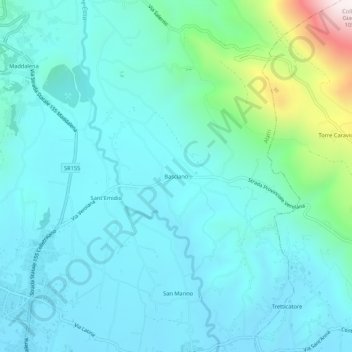
Name: Basciano topographic map, elevation, terrain.
Location: Basciano, Alatri, Frosinone, Lazio, 03011, Italia (41.68399 13.35403 41.72399 13.39403)
Average elevation: 369 m
Minimum elevation: 238 m
Maximum elevation: 1,051 m
Thank you for supporting this site ❤️
Make a donation
Make a donation
Gear up for your next adventure:
As an Amazon Associate, this site earns from qualifying purchases at no extra cost to you.