
Cerro Peña Negra topographic map
Interactive map
Click on the map to display elevation.
About this map
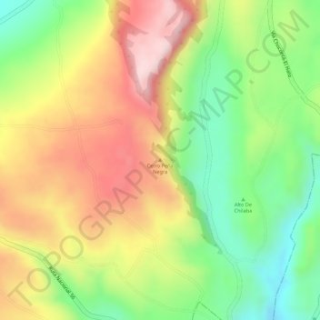
Name: Cerro Peña Negra topographic map, elevation, terrain.
Location: Cerro Peña Negra, Villa de Leyva, 251048, Colombia (5.18668 -73.72599 5.18678 -73.72589)
Average elevation: 2,936 m
Minimum elevation: 2,780 m
Maximum elevation: 3,085 m