
74193 topographic map
Interactive map
Click on the map to display elevation.
About this map
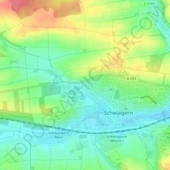
Name: 74193 topographic map, elevation, terrain.
Average elevation: 212 m
Minimum elevation: 183 m
Maximum elevation: 261 m
Other topographic maps
Click on a map to view its topography, its elevation and its terrain.
Stetten am Heuchelberg
Deutschland > Baden-Württemberg > Landkreis Heilbronn > Schwaigern
Average elevation: 230 m
Massenbach
Deutschland > Baden-Württemberg > Landkreis Heilbronn > Schwaigern
Massenbach liegt etwa zwei Kilometer nördlich von Schwaigern in der Talsenke des Biberbachs zwischen der Eselshöhe im Südwesten und dem Galgenberg im Südosten. Auf dem Bollenberg, einem Ausläufer des Galgenbergs, steht die Kirche des Ortes. Am südlichen Ortsende mündet der längere Biberbach in den…
Average elevation: 224 m