
Środa Wielkopolska County topographic map
Interactive map
Click on the map to display elevation.
About this map
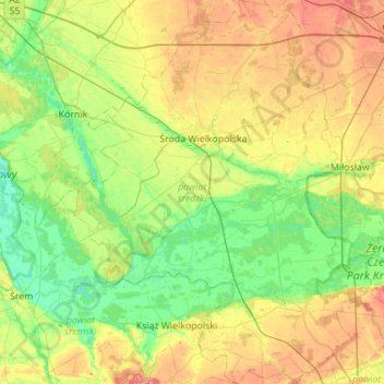
Name: Środa Wielkopolska County topographic map, elevation, terrain.
Location: Środa Wielkopolska County, Greater Poland Voivodeship, Poland (52.01047 17.09118 52.34914 17.52283)
Average elevation: 85 m
Minimum elevation: 57 m
Maximum elevation: 133 m
Other topographic maps
Click on a map to view its topography, its elevation and its terrain.