
Gongshan Derung and Nu Autonomous County topographic map
Interactive map
Click on the map to display elevation.
About this map
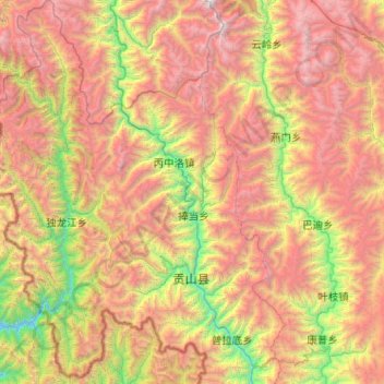
Name: Gongshan Derung and Nu Autonomous County topographic map, elevation, terrain.
Location: Gongshan Derung and Nu Autonomous County, Cikai, Yunnan, China (27.49457 98.13205 28.39710 98.91821)
Average elevation: 3,255 m
Minimum elevation: 1,318 m
Maximum elevation: 5,871 m