Geolocate

Sacapuc topographic map

Click on the map to display elevation.

About this map

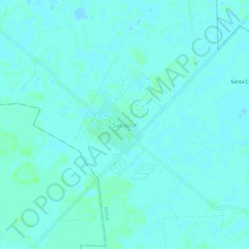
Name: Sacapuc topographic map, elevation, terrain.

Location: Sacapuc, Motul, Yucatán, Mexico (21.14554 -89.37426 21.18554 -89.33426)

Average elevation: 8 m

Minimum elevation: 6 m

Maximum elevation: 11 m

Gear up for your next adventure:

🚲Cycling GPS Computers - Track elevation and topographic routes on two wheels
🥤Hydration Bladders - Hands-free hydration systems for backpacks
🧭Orienteering Compasses - Accurate compasses for map-based navigation
📻Hand-Crank Emergency Radios - Stay updated on weather warnings in remote areas
🎒Hiking Daypacks - Compact backpacks ideal for short hikes and excursions

As an Amazon Associate, this site earns from qualifying purchases at no extra cost to you.