
Steenkerque topographic map
Interactive map
Click on the map to display elevation.
About this map
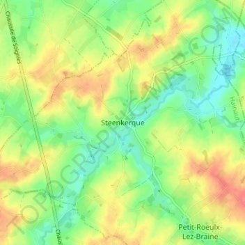
Name: Steenkerque topographic map, elevation, terrain.
Location: Steenkerque, Henegouwen, Wallonië, 7090, België (50.62282 4.04898 50.66282 4.08898)
Average elevation: 73 m
Minimum elevation: 47 m
Maximum elevation: 103 m