
Thank you for supporting this site ❤️
Make a donation
Make a donation
Gear up for your next adventure:
As an Amazon Associate, this site earns from qualifying purchases at no extra cost to you.
Anzali topographic map
Click on the map to display elevation.
Thank you for supporting this site ❤️
Make a donation
Make a donation
Gear up for your next adventure:
As an Amazon Associate, this site earns from qualifying purchases at no extra cost to you.
About this map
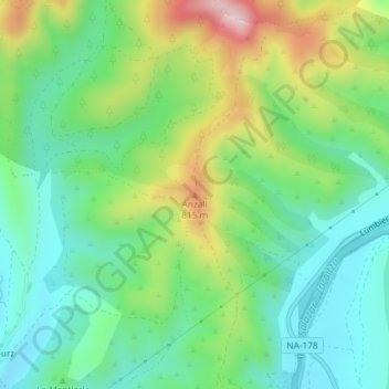
Name: Anzali topographic map, elevation, terrain.
Location: Anzali, Navascués/Nabaskoze, Pirinioak / Pirineo, 25549, Spain (42.73542 -1.13618 42.73552 -1.13608)
Average elevation: 677 m
Minimum elevation: 572 m
Maximum elevation: 889 m
Thank you for supporting this site ❤️
Make a donation
Make a donation
Gear up for your next adventure:
As an Amazon Associate, this site earns from qualifying purchases at no extra cost to you.