
Dhulikhel topographic map
Interactive map
Click on the map to display elevation.
About this map
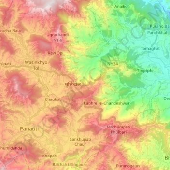
Name: Dhulikhel topographic map, elevation, terrain.
Location: Dhulikhel, Kavrepalanchok, Bagmati Province, Nepal (27.55370 85.53047 27.68175 85.62797)
Average elevation: 1,369 m
Minimum elevation: 754 m
Maximum elevation: 2,018 m
Other topographic maps
Click on a map to view its topography, its elevation and its terrain.
Tukucha Nala
Nepal > Bagmati Province > Kavrepalanchok
Tukucha Nala, Banepa, Kavrepalanchok, Bagmati Province, 46210, Nepal
Average elevation: 1,533 m
Bhakunde Besi
Nepal > Bagmati Province > Kavrepalanchok
Bhakunde Besi, Namobuddha, Kavrepalanchok, Bagmati Province, 45205, Nepal
Average elevation: 1,283 m