Geolocate

Sapinit topographic map

Click on the map to display elevation.

About this map

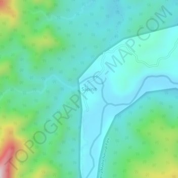
Name: Sapinit topographic map, elevation, terrain.

Location: Sapinit, Isabela, Cagayan Valley, 3335, Philippines (17.28014 122.21446 17.32014 122.25446)

Average elevation: 166 m

Minimum elevation: 21 m

Maximum elevation: 714 m

Gear up for your next adventure:

🛌Insulated Sleeping Mats - Crucial thermal protection when sleeping on cold, uneven ground
🧢Hiking Hats - Sun and weather protection for outdoor walks
📷Camera Straps - Secure straps for carrying cameras while walking
🔦Head Torches - Hands-free lighting for hiking and camping
📸Action Camera Chest Mounts - Record your ascent following topographic paths hands-free

As an Amazon Associate, this site earns from qualifying purchases at no extra cost to you.