
Río Sacambaya topographic map
Interactive map
Click on the map to display elevation.
Río Sacambaya
Der Río Sacambaya bildet sich am Ostrand der Kordillere Quimsa Cruz aus der Vereinigung des Río Ayopaya mit dem Río Ichoca-Colquiri in einer Höhe von 1734 m. Der Fluss fließt ab seiner Entstehung in nordöstlicher Richtung und bildet nach 37 Kilometern zusammen mit dem von rechts einmündenden Río Negro anschließend den Río Cotacajes. Auf der gesamten Strecke bildet der Río Sacambaya die Grenze zwischen dem Departamento Cochabamba und dem Departamento La Paz.
About this map
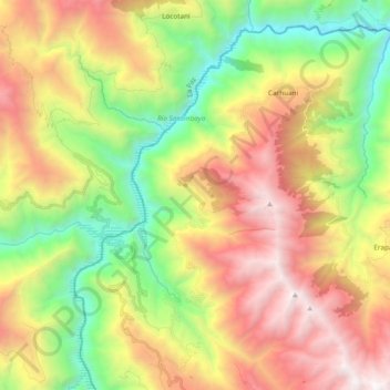
Name: Río Sacambaya topographic map, elevation, terrain.
Average elevation: 2,735 m
Minimum elevation: 1,445 m
Maximum elevation: 4,337 m
Other topographic maps
Click on a map to view its topography, its elevation and its terrain.