
Fontenoy topographic map
Interactive map
Click on the map to display elevation.
About this map
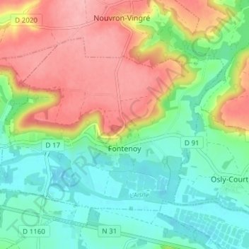
Name: Fontenoy topographic map, elevation, terrain.
Average elevation: 81 m
Minimum elevation: 33 m
Maximum elevation: 149 m
Other topographic maps
Click on a map to view its topography, its elevation and its terrain.
Saint-Thomas
Frankreich > Nordfrankreich > Aisne
Saint-Thomas, Laon, Aisne, Nordfrankreich, Metropolitanes Frankreich, 02820, Frankreich
Average elevation: 148 m