
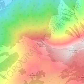
Rosenkogel topographic map
Interactive map
Click on the map to display elevation.
About this map
Name: Rosenkogel topographic map, elevation, terrain.
Average elevation: 1,172 m
Minimum elevation: 457 m
Maximum elevation: 1,764 m
Other topographic maps
Click on a map to view its topography, its elevation and its terrain.
Tauern
Austria > Upper Austria > Bezirk Gmunden > Bad Ischl
Tauern, Bad Ischl, Bezirk Gmunden, Upper Austria, 4820, Austria
Average elevation: 1,041 m