Geolocate

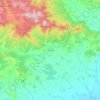
Pevtsite topographic map

Click on the map to display elevation.

About this map

Name: Pevtsite topographic map, elevation, terrain.

Location: Pevtsite, Karlovo, Plovdiv, 4334, Bulgaria (42.65427 24.63686 42.69427 24.67686)

Average elevation: 461 m

Minimum elevation: 391 m

Maximum elevation: 629 m

Other topographic maps

Click on a map to view its topography, its elevation and its terrain.
Централен

Bulgaria > Plovdiv > Plovdiv

Average elevation: 168 m

Hisaria

Bulgaria > Plovdiv

Average elevation: 524 m

Западен

Bulgaria > Plovdiv > Plovdiv

Average elevation: 172 m

Южен

Bulgaria > Plovdiv

Average elevation: 173 m

Централен

Bulgaria > Plovdiv

Average elevation: 168 m

Hisaria

Bulgaria > Plovdiv

Average elevation: 524 m

Източен

Bulgaria > Plovdiv

Average elevation: 159 m

Южен

Bulgaria > Plovdiv

Average elevation: 173 m

Gear up for your next adventure:

🔦Outdoor Torches - Reliable torches for night navigation
🧊Personal Water Filters - Drink safely from mountain streams marked on your map
👟Heavy Duty Boot Laces - Always carry a spare for your hiking footwear
🗺️Ordnance Survey Maps - Official UK maps for walking and outdoor activities
🕶️Polarized Sunglasses - Reduces glare from snow and water when reading terrain

As an Amazon Associate, this site earns from qualifying purchases at no extra cost to you.