
Obersaxen-Mundaun topographic map
Interactive map
Click on the map to display elevation.
About this map
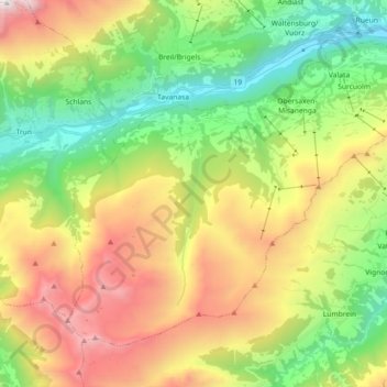
Name: Obersaxen-Mundaun topographic map, elevation, terrain.
Location: Obersaxen-Mundaun, Surselva, Grauwbunderland, Zwitserland (46.67482 9.01014 46.77238 9.19068)
Average elevation: 1,692 m
Minimum elevation: 723 m
Maximum elevation: 3,171 m