
Thank you for supporting this site ❤️
Make a donation
Make a donation
Gear up for your next adventure:
As an Amazon Associate, this site earns from qualifying purchases at no extra cost to you.
Bowmanville topographic map
Click on the map to display elevation.
Thank you for supporting this site ❤️
Make a donation
Make a donation
Gear up for your next adventure:
As an Amazon Associate, this site earns from qualifying purchases at no extra cost to you.
About this map
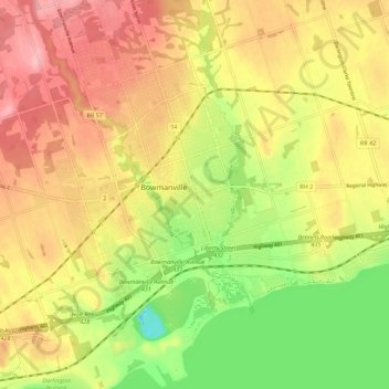
Name: Bowmanville topographic map, elevation, terrain.
Location: Bowmanville, Durham Region, Ontario, L1C, Canada (43.87076 -78.72031 43.95076 -78.64031)
Average elevation: 108 m
Minimum elevation: 26 m
Maximum elevation: 178 m
Thank you for supporting this site ❤️
Make a donation
Make a donation
Gear up for your next adventure:
As an Amazon Associate, this site earns from qualifying purchases at no extra cost to you.