Geolocate

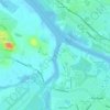
Johnstone topographic map

Click on the map to display elevation.

About this map

Name: Johnstone topographic map, elevation, terrain.

Location: Johnstone, Renfrewshire, Scotland, PA5 8DT, United Kingdom (55.79652 -4.55228 55.87652 -4.47228)

Average elevation: 65 m

Minimum elevation: 1 m

Maximum elevation: 234 m

Renfrewshire trails, hiking, mountain biking, running and outdoor activities

Other topographic maps

Click on a map to view its topography, its elevation and its terrain.
River Cart

United Kingdom > Scotland > Renfrewshire > Renfrew

Average elevation: 6 m

Gear up for your next adventure:

🛰️Outdoor GPS Navigation - Navigation devices for remote and off-grid areas
🎿Telescopic Trekking Poles - Reduces knee strain on steep topographic descents
🧥Breathable Waterproof Jackets - Essential rain protection for the unpredictable British climate
🥄Titanium Camping Sporks - The ultimate lightweight utensil for trail meals
⌚Altimeter Watches - Watches measuring altitude for mountain activities

As an Amazon Associate, this site earns from qualifying purchases at no extra cost to you.