
Thank you for supporting this site ❤️
Make a donation
Make a donation
Gear up for your next adventure:
As an Amazon Associate, this site earns from qualifying purchases at no extra cost to you.
Mamhilad topographic map
Click on the map to display elevation.
Thank you for supporting this site ❤️
Make a donation
Make a donation
Gear up for your next adventure:
As an Amazon Associate, this site earns from qualifying purchases at no extra cost to you.
About this map
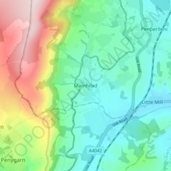
Name: Mamhilad topographic map, elevation, terrain.
Location: Mamhilad, Monmouthshire, Wales, NP4 0JF, United Kingdom (51.70539 -3.02721 51.74539 -2.98721)
Average elevation: 176 m
Minimum elevation: 57 m
Maximum elevation: 446 m
Monmouthshire trails, hiking, mountain biking, running and outdoor activities
Thank you for supporting this site ❤️
Make a donation
Make a donation
Gear up for your next adventure:
As an Amazon Associate, this site earns from qualifying purchases at no extra cost to you.